Data insights driven by the Road Risk Engine
DriveFactor's Road Risk Engine represents the next generation of road safety modelling. It continuously integrates collision records, road geometry, traffic flow and environmental conditions to produce high-resolution models of risk across road networks.
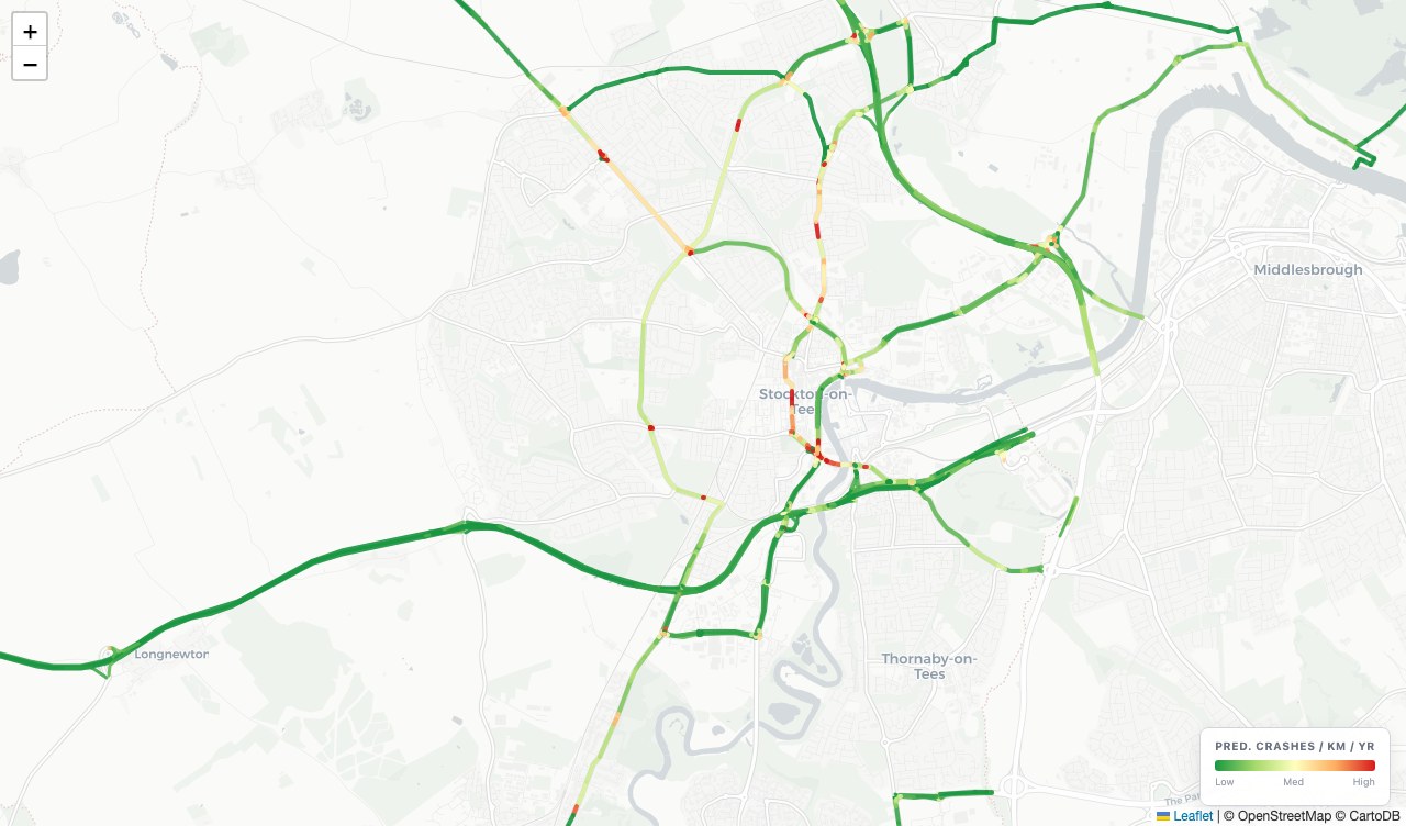
Spatial Risk Predictions
Collision probability per road segment, predicted from road geometry, features, network layout, speed limits and historical collision density.
View product →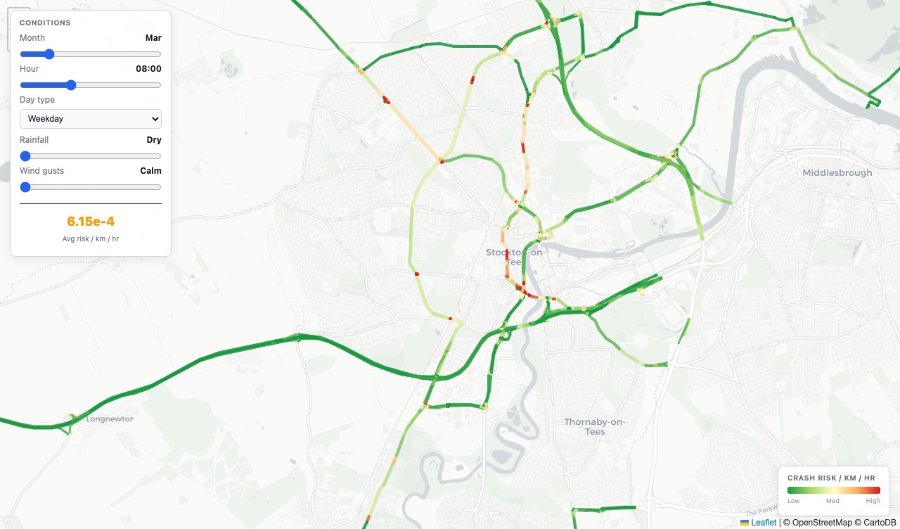
Dynamic Risk Modelling
Models how traffic volume, weather, light conditions and time of day combine to shift collision likelihood across the network — giving a time-sensitive picture of where and when risk is elevated.
View product →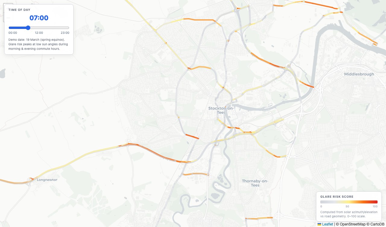
Sun Glare Intensity Maps
Models sun trajectory alignment with road geometry. Identifies which segments face direct sun exposure by time of day and season, and flags periods of severe glare risk.
View product →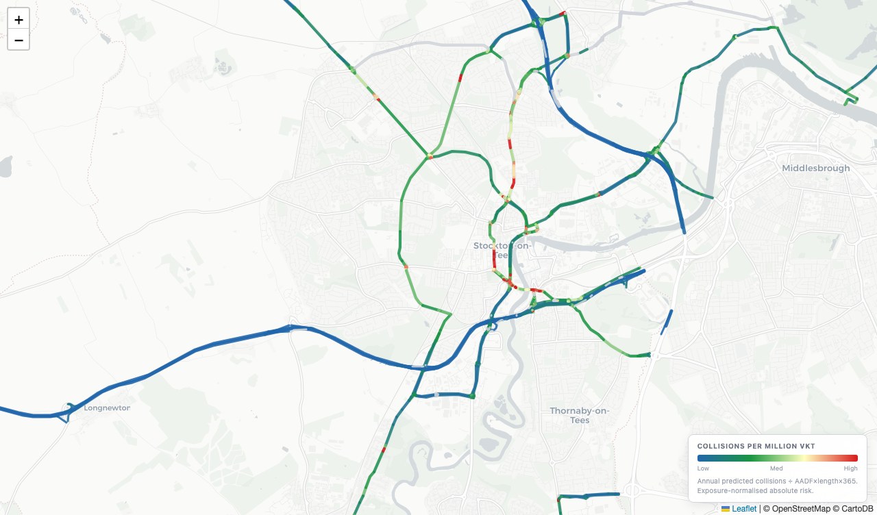
Absolute Road Risk
Collision risk per vehicle kilometre travelled — the likelihood that any given journey on a segment results in a collision. Exposes genuinely dangerous roads, not just busy ones.
View product →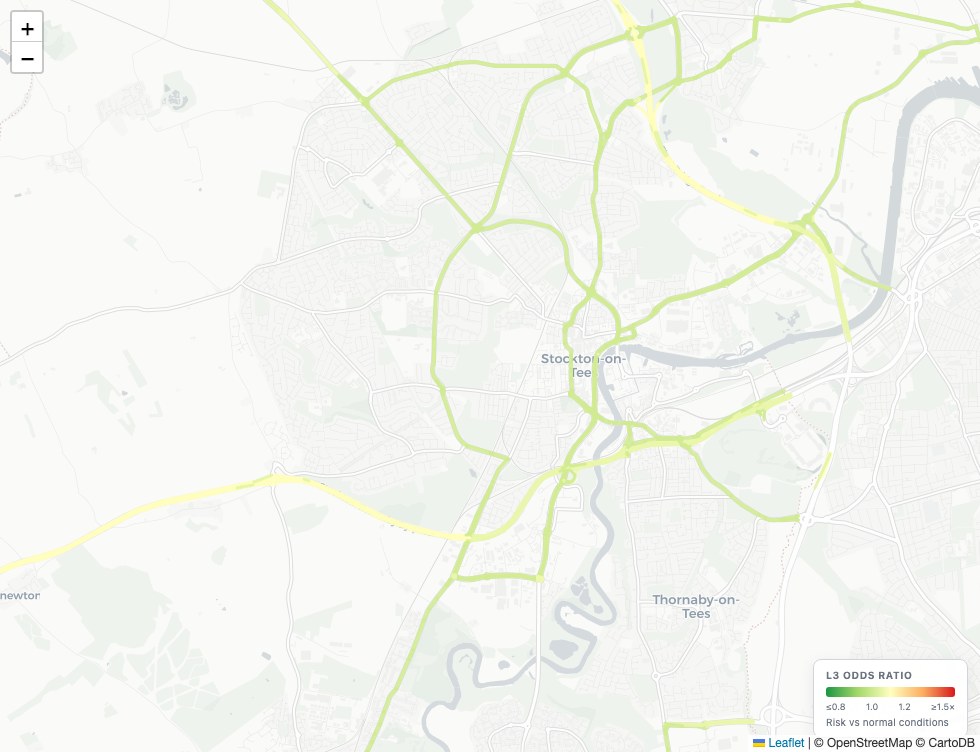
Traffic Risk Modelling
Simulate how changes in traffic flow and congestion affect collision risk, built on sensor network data and collision patterns.
View product →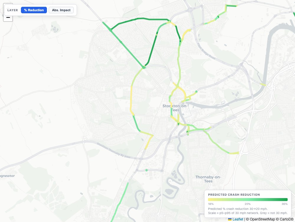
Road Safety Intervention Planner
Predict the expected collision reduction from a road safety intervention, grounded in measured scheme outcomes from across the UK network.
View product →